The city of Louisville’s Sustainability Office commissioned a tree canopy study from Davey Resource Group and created a detailed report of the results. Louisville needs more trees to combat its urban heat island problem, which shows our city having the fastest growing problem in the nation.

The city took that study’s information and created a tree canopy online map, but the CDA wanted to look at the data in a different way, showing it more granularly (by property parcel at higher zoom levels), adding interactivity, and also merging property taxes.
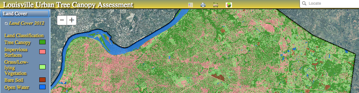
So CDA took the parcels tree estimates from the 2012 Tree Canopy data on Louisville’s Open Data Portal and merged it with the Sheriff’s department’s 2014 Tax File open data to create a tree coverage and property tax maps for all of Jefferson County. For each parcel you can get information like tree coverage, acres, tax value, and tax dollars per acre.
We hope these tools can inform the public about the importance of tree coverage in their neighborhood, how trees affect on property values, and the value of having detailed open public data.
Here are the first 3 maps we have made using this data:
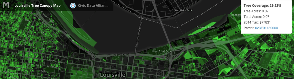
- Bright Green = Many trees
- Dark green = Few trees
- Black = No trees
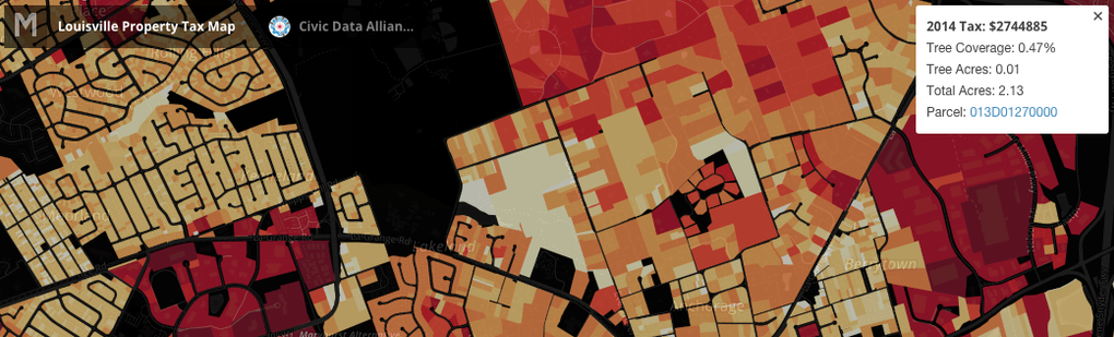
- Red = High Tax
- Orange = Mid Tax
- Yellow = Low Tax
- Black = No tax collected (gov, non-profit, infrastructure)
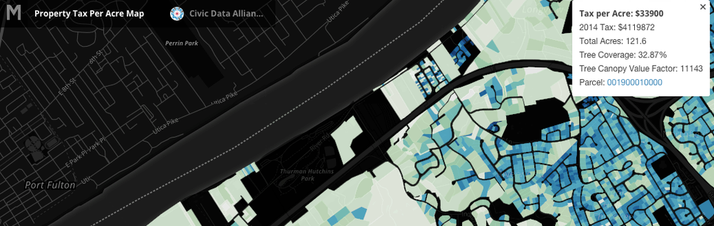
- Dark blues = $100 to $10,000+ per acre.
- Mid range = $70 to $25.
- Light greens/white < $10 per acre.
- Black = No tax collected (gov, non-profit, infrastructure)
RAW DATA
Visit our open data portal to get the full Shapefile and CSV data that we created to build our maps, and create your own visualizations.
Each parcel has these fields:
- Parcel (Parcel) - unique ID, can be used to merge with other datasets.
- Tree Canopy Percentage (CanP) - percent tree coverage in this parcel.
- Tree Canopy Acreage (CanA) - total tree acreage covered in parcel.
- Total Acreage (Acres) - size of parcel.
- 2014 Taxed Property Value (2014Tax) - Property tax due, in dollars.
- Tax Per Acre (TaxAcre) - 2014Tax/Acres: to get the cost per acre in dollars.
- Canopy Value Factor (CanVal) - TaxAcre*CanP: formula for looking at impact of tree data across property value.
Tax Value comes from the Sheriff’s Department online tax roll for 2014.
Tree Coverage and parcel outlines come from Louisville Metro’s open data portal.
THANKS
We would like like to thank Lyzi Diamond, Maptime founder, for personally teaching us how map such large quantities of data using Mapbox, the mayor and Ted Smith and Matthew Gotth-Olsen for having transparent and open government data, and Maria Koetter at the Sustainability Office for creating the study data.
RELATED PRESS
Metro Louisville Mayor - Open Data Portal is powerful toolbox for creative minds
Courier-Journal - Louisville hackers code for public good
WFPL - How Computer Hacking Can Improve Louisville’s Public Policy
Insider Louisville - Largest-ever national convening of civic hackers set for Saturday
Insider Louisville - Civic hackers face heavy financial obstacle for data from Jefferson County PVA